Research
Where Klorad began.
Klorad started as a question in a doctoral thesis, and an architecture built to answer it.
One formal model for 3D, geospatial worlds.
Every 3D geospatial project used to rebuild the same foundation. The thesis replaced that with one model that any number of worlds can share.
Define once
A world is its geometry, data and meaning, not one engine's drawing.
Render anywhere
The same model drives any renderer; changing engines is not a rewrite.
Build on shared ground
Every project inherits the foundation; effort goes to the new problem.
The architecture, peer reviewed.
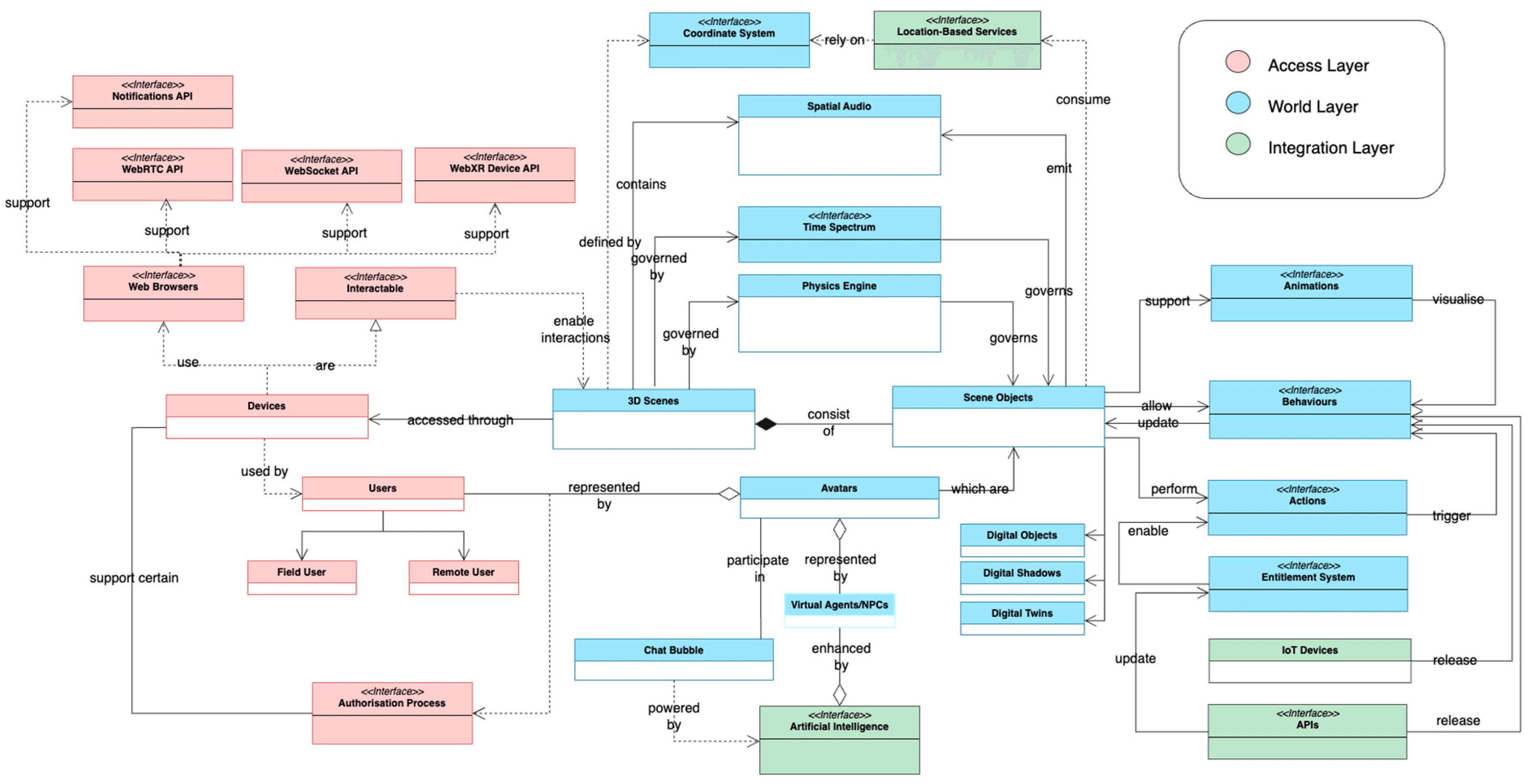
A system model that puts geospatial data at the core of virtual worlds, in three layers that bring digital twins, live sensor data and multi user interaction into one architecture.
Papadopoulos, T., Evangelidis, K., Kaskalis, T. H., and Evangelidis, G. (2025). The Metaverse Is Geospatial: A System Model Architecture Integrating Spatial Computing, Digital Twins, and Virtual Worlds. ISPRS Int. J. Geo-Inf. 14(3), 126.
The work around it.
- The Metaverse Is Geospatial: A System Model Architecture ISPRS Int. J. Geo-Inf., 2025.
- Interactions in Augmented and Mixed Reality: An Overview Applied Sciences, 2021.
- Mixed Reality and the Internet of Things: Bridging the Virtual with the RealAdvances in Engineering Software, 2023.
All publications
- Mixed Reality: A Reconsideration Based on Mixed Objects and Geospatial Modalities Applied Sciences, 2021.
- Mergin' Mode: Mixed Reality and Geoinformatics for Monument Demonstration Applied Sciences, 2020.
- 3D Geospatial Visualizations: Animation and Motion Effects on Spatial ObjectsComputers & Geosciences, 2018.
- A JavaScript GIS Platform Based on Invocable Geospatial Web Services Geosciences, 2018.
- Web-GIS Development for Geospatial Data Dissemination in EU Operational ProgrammesEuropean Journal of Geography, 2018.
- Immersive Mixed Reality Experience Empowered by the Internet of Things and Geospatial TechnologiesCivil-Comp Press, 2022.
- Is There Life in Virtual Globes?2016.
The projects it grew out of.
Mergin' Mode, co financed by the EU (ERDF), merged real and virtual monuments in mixed reality, as location based experiences on OGC standards. FIREFLY models cognitive abilities in real time.
A technology provider for your consortium.
A partner for funded projects that ship working software. Klorad joins as the technology provider for the digital twin work package; paste the profile below as it stands.
Prieston Technologies (Thessaloniki, Greece) develops Klorad, which connects a place, its systems and the people who run it into one live picture. Its system model comes from doctoral research in spatial computing and geospatial science at the University of Macedonia; a paper from the thesis was published in the ISPRS International Journal of Geo-Information. The model has three layers (World, Access, Integration) and four pillars (space, time, physical correspondence, interaction and actuation). Klorad connects existing systems through open standards (MQTT, OGC SensorThings, ETSI NGSI-LD, CityGML, IFC) and runs on Klorad Cloud, Dedicated or Sovereign: Klorad's cloud, a dedicated environment or a project's own servers.
Propose a joint project.
Tell us the call, the consortium and the work package. We answer with what Klorad brings to it.